The 37 Geospatial Python Packages You Definitely Need

When performing geospatial analysis, the right set of tools can be the difference between surface-level insights and deep, actionable intelligence. Fortunately, amazing geospatial Python packages help to bridge this gap. Python, renowned for its versatility and robustness, offers a wide range of packages that can not only help you scale your spatial analysis, but reach this deeper level of insight. These packages represent the packages that I have used most over the years to help me use larger data and find deeper insights.
The list features packages that broadly fall into these categories:
- Data Retrieval and Management: Packages like Fiona and GDAL that are pivotal for accessing, processing, and managing geospatial data.
- Mapping and Visualization: Tools such as Cartopy and Folium, which transform data into insightful, interactive maps and visual representations.
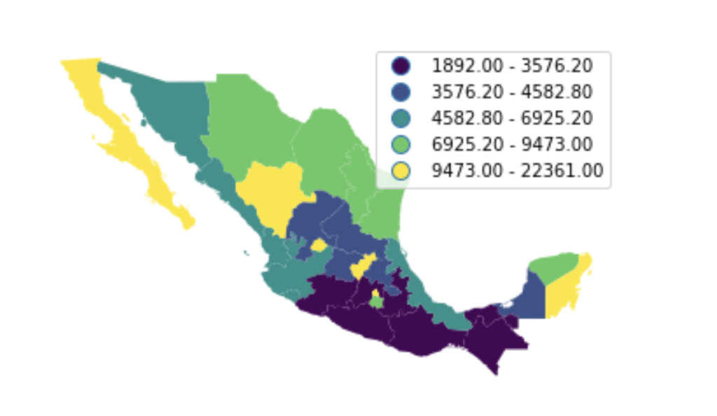
- Spatial Analysis and Modelling: Libraries like Geopandas and Rasterio, essential for sophisticated spatial computations and analyses.
- Machine Learning and Statistical Analysis: Advanced packages like Scikit-learn and XGBoost that integrate machine learning with geospatial data.
- Utility and Support Tools: Utilities like PySAL and Geopy that provide additional support and functionalities to bolster your geospatial analysis.
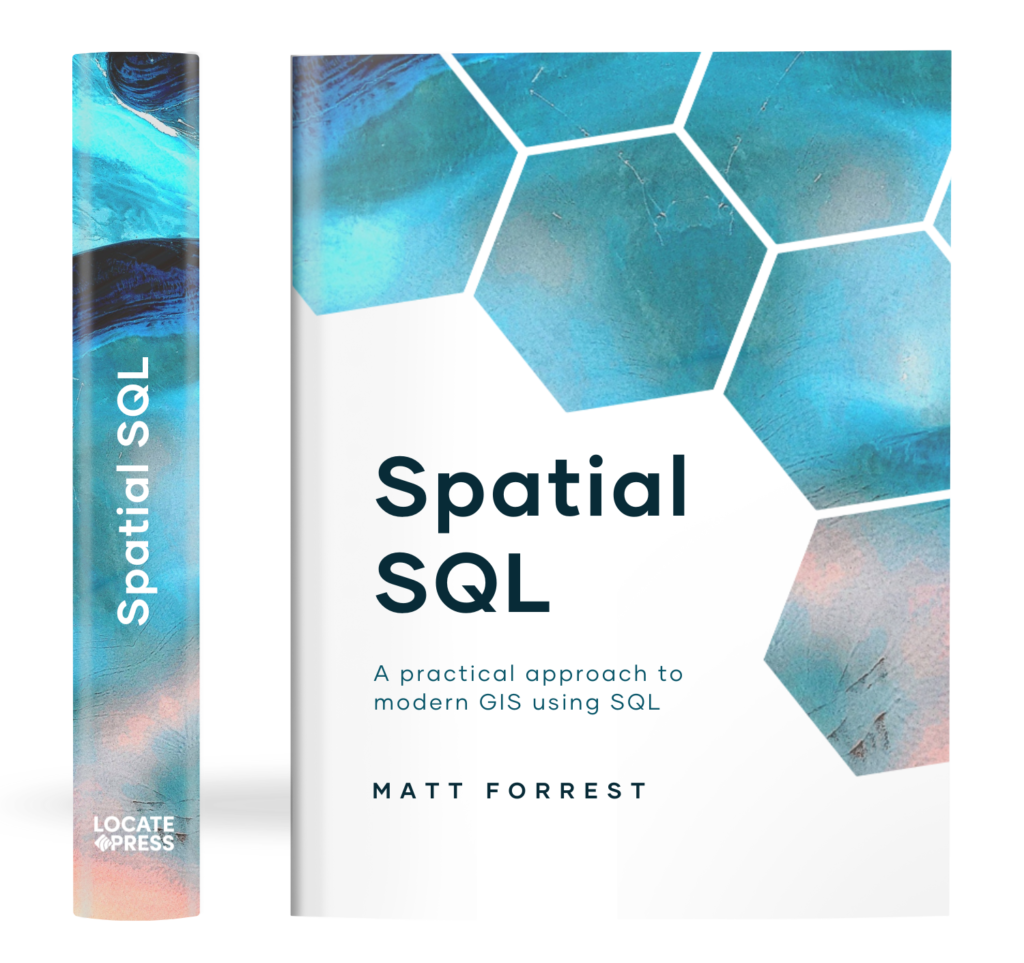
The Spatial SQL Book – Available now!
Check out my new book on Spatial SQL with 500+ pages to help you go from SQL novice to spatial SQL pro.
This selection of geospatial Python packages helps you find the tools needed to master the complexities of geospatial data and emerge with a deeper understanding of how to manipulate, analyze, and visualize the spatial dimension of your datasets.
The 37 essential geospatial Python packages
1. Access (access)
Homepage: Access on PyPI
Description: The ‘Access’ package, a part of the PySAL ecosystem, is a powerful tool designed for spatial accessibility analysis across various domains including health, retail, and employment. It focuses on addressing the spatial mismatches between the supply (e.g., services) and demand (e.g., consumers) locations. By measuring how close demand locations are to supply locations, it offers vital insights into spatial dynamics.
2. Cartopy (cartopy)
Homepage: Cartopy Documentation
Description: Cartopy is a geospatial Python package designed for advanced map creation and spatial analysis. It supports a wide range of map projections and transformations, enabling the creation of high-quality maps. Cartopy is especially useful for geospatial data visualizations where accurate geographic representations are crucial.
3. CatBoost (catboost)
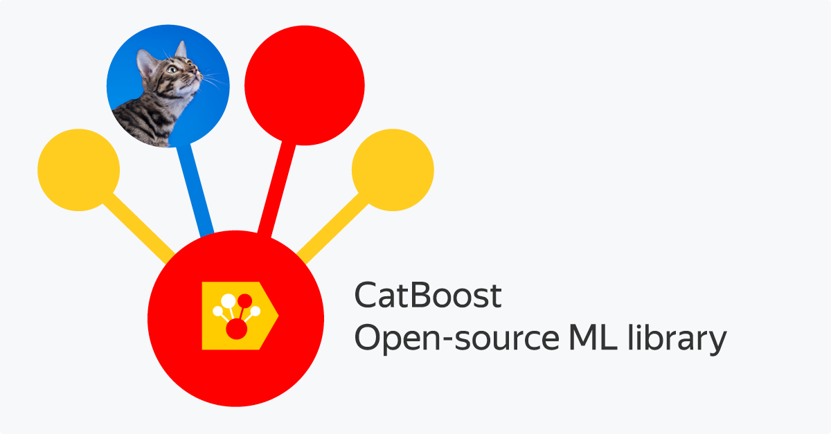
Homepage: CatBoost Official Site
Description: CatBoost is a high-performance, open-source machine learning library. While not exclusively for geospatial data, its ability to handle categorical features effectively makes it a strong choice for modeling geospatial datasets, especially those with complex, non-numeric information.
4. Dask-Geopandas (dask-geopandas)
Homepage: Dask-Geopandas on GitHub
Description: Dask-Geopandas extends the capabilities of Geopandas with the parallel computing power of Dask. This integration enables efficient handling of large geospatial datasets that exceed memory limits, making it possible to perform complex spatial computations on larger-than-memory data.
5. Datashader (datashader)
Homepage: Datashader Documentation
Description: Datashader by Anaconda is a graphics pipeline system that uses visualization and aggregation techniques to handle large datasets. It’s particularly effective for geospatial data, as it can render billions of points or pixels into images, aiding in the analysis and visualization of large spatial datasets.
6. EarthPy (earthpy)
Homepage: EarthPy Documentation
Description: EarthPy simplifies the handling and plotting of Earth science data. It’s a user-friendly package that provides utilities to work with raster and vector data, making it easier for researchers and scientists to manipulate common Earth science datasets and perform spatial analyses.
7. Easystac (easystac)

Homepage: Easystac on PyPI
Description: Easystac is designed to interact with the SpatioTemporal Asset Catalog (STAC). It provides a straightforward Python interface for accessing, searching, and manipulating satellite imagery and other Earth observation data, making it a valuable tool for remote sensing and satellite data analysis.
8. Esda (esda)
Homepage: Esda on PyPI
Description: Esda, or Exploratory Spatial Data Analysis, is a geospatial Python package offering a suite of tools for the in-depth exploration and analysis of geospatial data. It focuses on identifying spatial patterns, spatial autocorrelation, and other spatial relationships, essential for detailed geospatial data studies.
9. Fiona (fiona)
Homepage: Fiona Documentation
Description: Fiona is centered around reading and writing geospatial data files. It provides a minimalistic and Pythonic interface for handling spatial data, making the process of reading from and writing to various vector file formats both straightforward and efficient.
10. Folium (folium)
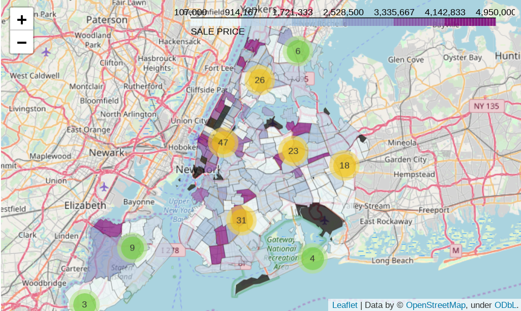
Homepage: Folium Documentation
Description: Folium is a powerful geospatial Python library used to create interactive maps. Leveraging the capabilities of the Leaflet.js library, Folium makes it easy to visualize data that’s been manipulated in Python on an interactive Leaflet map, offering a bridge between Python and Leaflet.js.
11. GDAL (GDAL)
Homepage: GDAL Official Site
Description: The Geospatial Data Abstraction Library (GDAL) is a cornerstone in spatial data processing. It provides robust tools for reading, writing, and analyzing raster and vector data in multiple formats. GDAL’s versatility and support for numerous file formats make it a staple in geospatial workflows.
12. Geemap (geemap)

Homepage: Geemap on GitHub
Description: Geemap is a geospatial Python library designed to simplify the use of Google Earth Engine for geospatial data analysis. It provides an interactive environment for mapping and analyzing large-scale geospatial datasets, particularly satellite imagery, making it invaluable for remote sensing and environmental analysis.
13. GeoAlchemy2 (geoalchemy2)
Homepage: GeoAlchemy2 Documentation
Description: GeoAlchemy2 extends SQLAlchemy, a SQL toolkit for Python, to include support for geospatial databases. It provides a powerful, expressive toolkit for working with spatial databases using object-relational mapping, making it essential for projects that involve spatial data and databases.
14. Geopandas (geopandas)
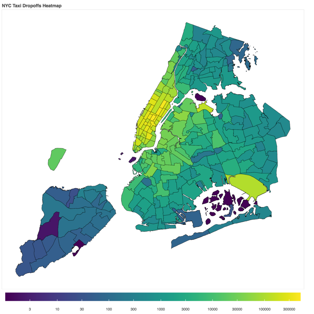
Homepage: Geopandas Documentation
Description: Geopandas is an open-source project that extends the datatypes used by pandas to allow spatial operations on geometric types. It integrates with other Python libraries for geospatial data and provides high-level, user-friendly data structures and methods for spatial data analysis and manipulation.
15. Geopy (geopy)
Homepage: Geopy Documentation
Description: Geopy is a geospatial Python library for accessing various geocoding services. It simplifies the process of geocoding (converting addresses into coordinates) and reverse geocoding, along with other tools for computing distances between locations, making it a versatile toolkit for geographic calculations.
16. Geosnap (geosnap)
Homepage: Geosnap on PyPI
Description: Geosnap facilitates the analysis of neighborhood dynamics over time. It provides tools for analyzing socioeconomic and demographic changes, making it particularly useful for urban planning, policy analysis, and social science research involving spatial and temporal data.
17. Geoviews (geoviews)

Homepage: Geoviews Documentation
Description: Geoviews is a Python library that makes it easy to create interactive maps and other geospatial visualizations. It offers a high-level interface to visualize data drawn from a wide range of sources, seamlessly integrating with other geospatial Python data tools.
18. Graph-tool (graph-tool)
Homepage: Graph-tool Documentation
Description: Graph-tool is a Python module for manipulation and statistical analysis of graphs (networks). It provides extensive functionality for graph theory analysis, which can be applied in various fields, including geospatial network analysis, where understanding the relational dynamics is key.
19. H3 (h3)
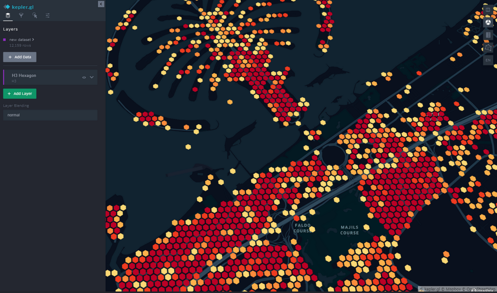
Homepage: H3 Documentation
Description: Developed by Uber, H3 is a hexagonal hierarchical spatial indexing system. This system partitions the world into hexagonal grids at various resolutions, providing a precise framework for spatial analysis, data visualization, and geospatial data storage.
20. H3-Py (h3-py)
Homepage: H3-Py on GitHub
Description: H3-Py offers Python bindings for the H3 spatial indexing system. This integration allows geospatial Python developers to leverage the power of H3’s hexagonal, hierarchical geospatial indexing for applications ranging from data analysis to optimizing ride-sharing algorithms.
21. iGraph (igraph)
Homepage: iGraph Documentation
Description: iGraph is a library for creating and manipulating graphs and networks. It is highly efficient and suitable for complex network analysis tasks. In geospatial contexts, iGraph is used for analyzing spatial networks, facilitating insights into connectivity, flow, and spatial relationships.
22. Inequality (inequality)
Homepage: Inequality on GitHub
Description: This Python package is part of the PySAL family and focuses on measuring inequality. It’s particularly useful in spatial data analysis for assessing disparities and distribution patterns within geospatial datasets, offering valuable insights for social and economic research.
23. Ipyleaflet (ipyleaflet)
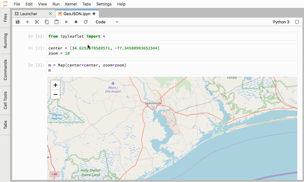
Homepage: Ipyleaflet Documentation
Description: Ipyleaflet is an extension to the Jupyter notebook, providing interactive map visualizations. It allows for the easy integration of maps into Jupyter notebooks, enhancing the data exploration and visualization experience in geospatial analysis and research.
24. Kepler.gl (keplergl)
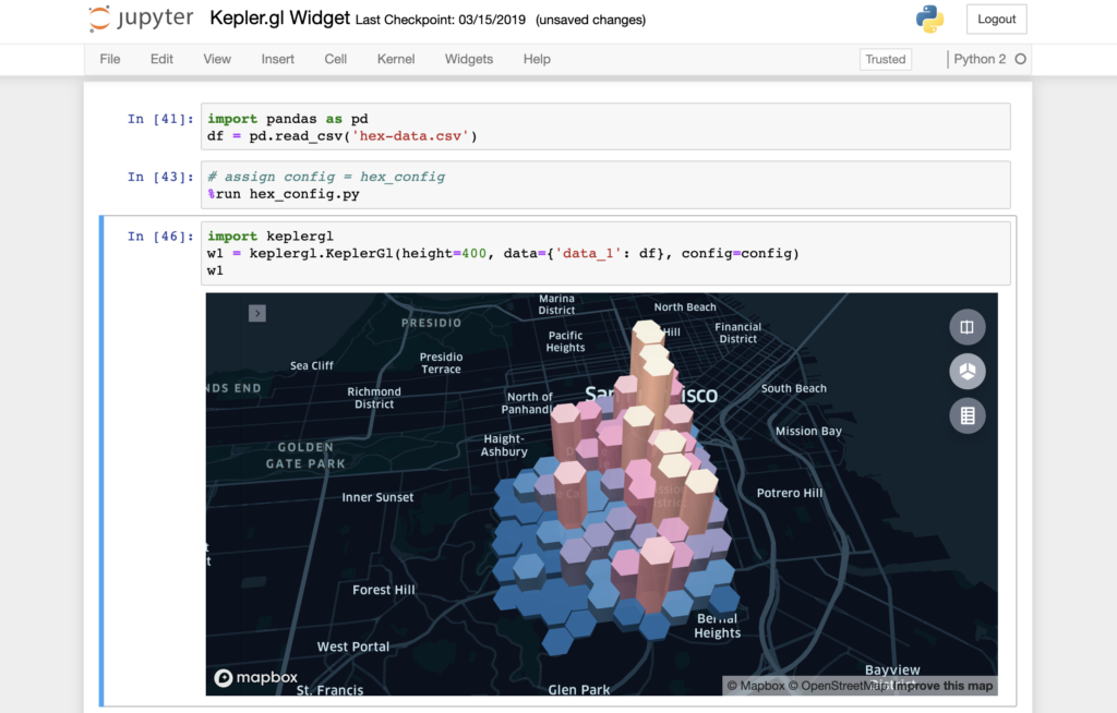
Homepage: Kepler.gl Documentation
Description: Kepler.gl is a powerful geospatial analysis tool for creating large-scale data visualizations. Its integration with Python allows for the exploration and visualization of large geospatial datasets, making it particularly useful for urban planning and data-driven storytelling.
25. Leafmap (leafmap)
Homepage: Leafmap
Description: Leafmap simplifies the process of creating interactive maps in Python. It offers various functionalities for map creation and geospatial data visualization, making it an excellent tool for both beginners and experienced users in geospatial analysis.
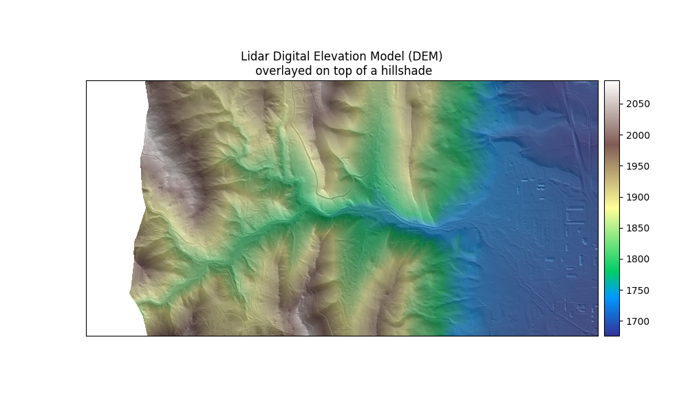
26. LiDAR (lidar)
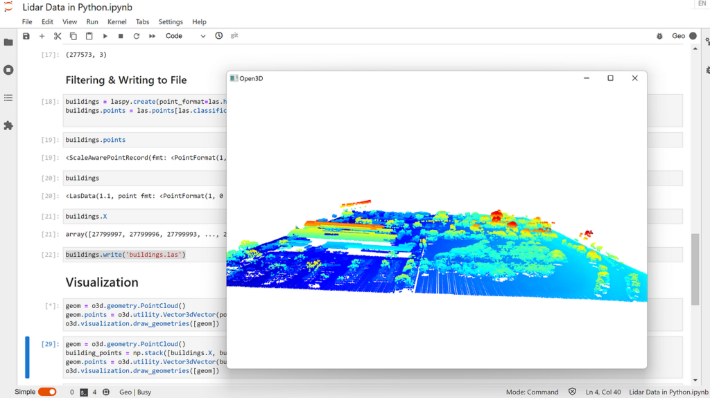
Homepage: LiDAR on PyPI
Description: The LiDAR package in Python is designed for processing and analyzing LiDAR point cloud data. It provides tools for filtering, processing, and visualizing LiDAR data, essential in applications like topographic modeling and forest management.
27. LocalTileServer (localtileserver)

Homepage: LocalTileServer on GitHub
Description: LocalTileServer is designed to serve local map tiles for geospatial applications. It facilitates the integration of high-resolution, local map tiles into geospatial Python workflows, enhancing the quality and detail of map-based visualizations.
28. Lonboard (lonboard)
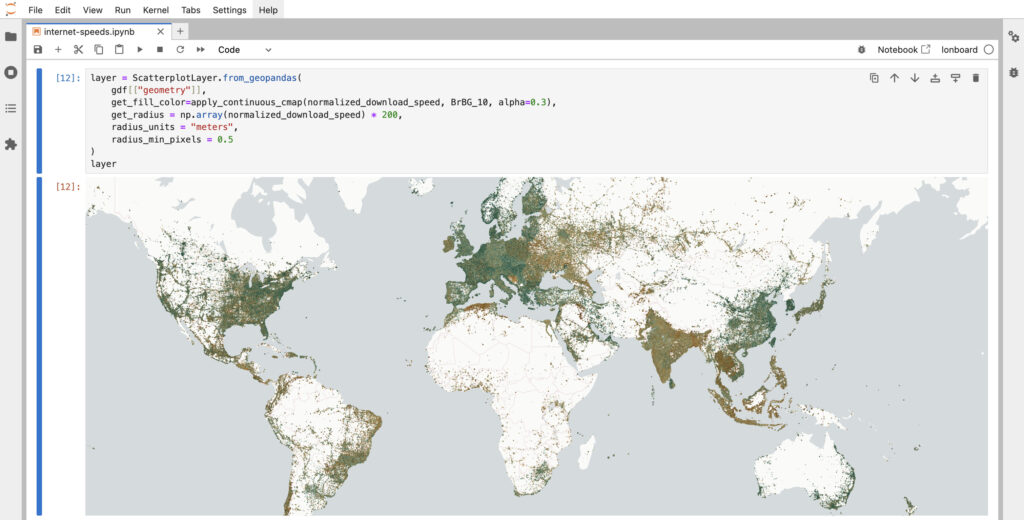
Homepage: Lonboard on GitHub
Description: Lonboard is a geospatial Python library that enables the rendering of large scale geospatial data within a Jupyter notebook environment. It uses GeoArrow and GeoParquet to create files that can be read and visualized quickly all within a notebook.
29. MapWidget (mapwidget)
Homepage: MapWidget Documentation
Description: MapWidget is a tool for integrating interactive map widgets in Python applications. It is particularly useful in web development or interactive data visualization projects involving spatial data as it has bindings for Cesium, Leaflet, Mapbox, MapLibre, and OpenLayers.
30. MGWR (mgwr)
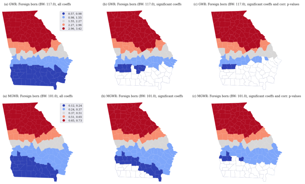
Homepage: MGWR on PyPI
Description: Multiscale Geographically Weighted Regression (MGWR) extends traditional geographically weighted regression by allowing varying scales of analysis. It’s crucial for spatial analysis in fields like urban planning, environmental science, and public health.
31. MovingPandas (movingpandas)
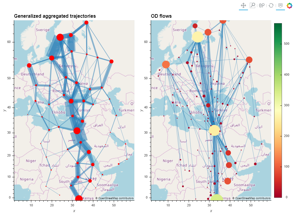
Homepage: MovingPandas Documentation
Description: MovingPandas provides a set of tools for the analysis of movement data. It’s designed to handle trajectory data and offers functionalities for trajectory analysis, visualization, and handling of movement data, useful in logistics, wildlife monitoring, and transportation.
32. NetCDF4 (netcdf4)
Homepage: NetCDF4 Documentation
Description: The NetCDF4 package in Python is used for reading and writing netCDF files, which are used for storing multidimensional scientific data. It’s essential in fields like meteorology, oceanography, and climate science for handling large-scale, complex datasets.
33. ODC-STAC (odc-stac)
Homepage: ODC-STAC on GitHub
Description: ODC-STAC integrates Open Data Cube with the SpatioTemporal Asset Catalog, allowing users to manage and analyze Earth observation data effectively. It’s particularly beneficial for remote sensing applications, environmental monitoring, and large-scale spatial data analysis.
34. OSMnet (osmnet)
Homepage: OSMnet on PyPI
Description: OSMnet is a Python package for downloading and constructing street networks from OpenStreetMap data. It’s particularly useful for urban and transportation planning, where accurate and detailed street network data are essential.
35. OSMnx (osmnx)
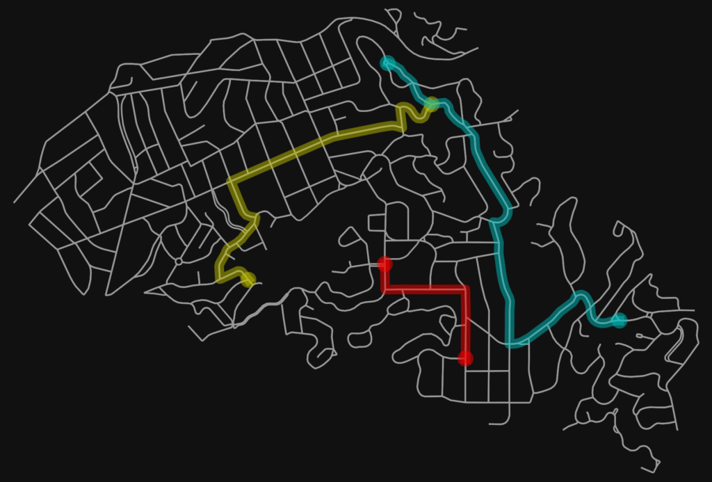
Homepage: OSMnx Documentation
Description: OSMnx is a Python package that simplifies the retrieval, construction, and visualization of street networks from OpenStreetMap data. It’s widely used in urban planning, geography, and transportation studies for analyzing and visualizing urban forms and street networks.
36. Pandana (pandana)
Homepage: Pandana on GitHub
Description: Pandana is a network analysis tool optimized for urban street networks. It allows for the analysis of urban accessibility and connectivity, making it a key tool for urban planners and researchers in the field of urban studies.
37. Path4GMNS (path4gmns)
Homepage: Path4GMNS on GitHub
Description: Path4GMNS is a lightweight, cross-platform Python library for transportation network modeling and analysis. It provides functionalities for traffic assignment, shortest path calculation, and network analysis, useful in transportation research and planning.