For decades, GIS has lived in a world of its own. Specialized software. Obscure formats. A profession that, despite being critical to everything from climate modeling to logistics, has remained siloed from the rest of the data world. But that’s finally starting to change. In the latest episode of the Spatial Stack podcast, I sat […]
From Desktop GIS to Cloud: A Beginner’s Roadmap to Modern GIS Tool
Modern GIS is changing fast. If you’ve been working with QGIS, ArcGIS, or any other desktop GIS tool, you’ve probably hit some limitations—datasets getting too big, processing times slowing down, and collaboration becoming a challenge. The good news? The cloud offers a way forward. But how do you make that transition? How do you go […]
The Top 11 Open GeoParquet Datasets: Making big geospatial data easy
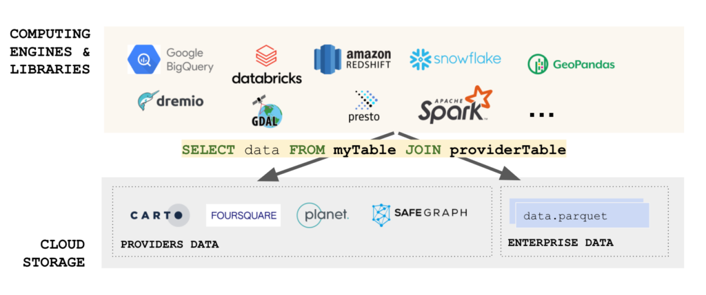
In the dynamic field of geospatial technology, the evolution of data formats plays a pivotal role in shaping how we interact with and interpret spatial information. The advent of GeoParquet has marked a significant milestone, offering a more efficient and accessible way to handle large spatial datasets. This blog post delves into a comprehensive exploration […]
GeoParquet will be the most important tool in modern GIS in 2022
Yes, (another) file format is the most important new development tool for the modern GIS stack in 2022. There is a ton of hype around tools, processes, and methods for making geospatial analysis faster and at scale, but what if the data (in this case vector data) was better formatted for different query performance both […]
Top Modern GIS Skills for Spatial Data Science in 2022
Spatial data science has been one of the fastest-growing career paths in modern GIS in the past few years. The combination of the boom in the data science path, proliferation and popularity of Python, and demand for more flexible/technical roles in data science and analytics have spilled over into modern GIS. Yet spatial data science […]

