
Why GIS Jobs Are So Underpaid (And How To Break Out of the Technician Trap)
One of the most talked-about issues in geospatial right now is the wide pay gap across GIS roles. You can find entry level jobs paying barely above the U.S. median income right next to roles at the same company paying well into the six figures. This is not just an isolated problem. It is a structural pattern baked into how the industry views GIS work.
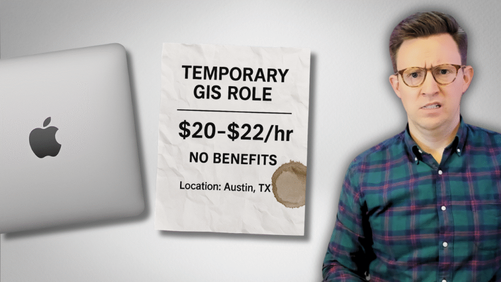
A recent example brought the issue back into focus. A contractor role for Apple Maps was posted at around forty five thousand dollars a year. The job involved updating GIS data for one of the largest mapping platforms in the world. It required ArcGIS or QGIS. It required Python and SQL. Yet the compensation fell far below the national average for analysts with those skills.
So why does this happen, and more importantly, what can you do about it?
The Pay Disparity Problem in GIS
The Apple posting is not an outlier. Many GIS job listings sit in the forty to sixty thousand dollar range. Yet the same company also hires geospatial data engineers for salaries between one hundred seventy eight thousand and three hundred twelve thousand dollars.
The surprising part is that on the surface, both roles seem related. Both deal with the quality of spatial data. Both support Apple Maps. Both involve spatial thinking.
So why does one pay four or five times more?
Because the value of the roles is perceived differently.
The lower paid role is positioned as labor. The higher paid role is positioned as strategy.
This is the core dynamic holding many GIS professionals back.
Understanding the Technician Trap
If you look closely at the contractor job, the expectations are simple.
Move data from A to B. Update features. Process up to three hundred data points a day.
Your value is measured by throughput.
In this model, you are an input to a system.
You are not designing workflows. You are not influencing decisions. You are not building anything that persists beyond the task.
This is the technician trap.
GIS professionals fall into it because so much early career work involves editing, cleaning, digitizing, and maintaining layers. These tasks matter, but when your value is defined only by outputs, the ceiling is low.
The work becomes interchangeable. The compensation follows.
What Higher Paying Roles Actually Require
Now compare the contractor role with the geospatial data engineer posting.
This role still focuses on data quality for Apple Maps. But it adds responsibility for:
- Designing quality checks
- Building metrics for large scale data
- Collaborating with data scientists, analysts, and cross functional teams
- Integrating geospatial data with cloud systems like AWS
- Working with Spark or distributed computing frameworks
- Optimizing spatial queries for performance
- Automating validation and testing
These are not tasks. They are systems.
They solve problems that affect entire teams.
They scale across the organization.
When your work becomes strategic, your compensation reflects that shift.
The Skills That Move You Out of the Technician Lane
The good news is that the path out of the technician trap is clear. There are two parts to it.
1. Technical capability
You do not need to know everything. You do need enough flexibility to design solutions rather than just execute them.
Examples include:
- Python for automation
- SQL for data validation and quality controls
- Cloud systems for data access and deployment
- Distributed computing (Spark, Sedona) for scale
- Enterprise GIS tools if your organization uses Esri
The specific tools are less important than the outcomes they enable.
Automation, repeatability, scalability, reliability.
2. Strategic positioning
Technical skill is not enough.
You must show that you understand what the business needs, how data moves through systems, and how your work affects decision making.
This is the difference between:
“I processed three hundred features a day.”
and
“I designed the workflow that reduces data QA time by 70 percent and supports the entire analytics team.”
Same tools.
Different value.
Radically different compensation.
How GIS Professionals Can Reposition Their Career
Here are the concrete steps that help you break out of low paying GIS roles and move into high value positions.
1. Identify whether your current role is task based or strategy based
Look at your daily work.
Are you pushing buttons and completing outputs?
Or understanding requirements, designing systems, and supporting multiple teams?
2. Shift your narrative from technician to problem solver
Stop describing yourself by the tools you use.
Start describing the problems you solve.
3. Build one automated workflow in your current job
Even a small automation project demonstrates scale, repeatability, and impact.
4. Demonstrate cross functional value
Talk with analysts, data scientists, engineers, or planners in your organization.
Ask what slows them down.
Design a spatial solution that removes that bottleneck.
5. Document your work so others can reuse it
Templates, data models, validation rules, scripts.
Systems create long term value.
Tasks do not.
6. Understand what the organization really needs
Strategic GIS professionals do not wait for instructions. They build what the business should be doing next.
Your Spatial Thinking Is More Valuable Than You Realize
GIS professionals often underestimate their own value.
You understand proximity, context, movement, patterns, and relationships.
These are not technician skills.
These are strategic skills that most analysts, engineers, and product teams do not have.
When you combine spatial reasoning with automation, SQL, cloud workflows, and system level thinking, you become the person who can solve problems nobody else can see.
That is what companies pay for.
The Two Real Paths Forward From Here
If you want jobs like the geospatial data engineer posting, the path is not mysterious. It comes down to:
- Closing the technical gap
- Repositioning your career narrative
Every GIS professional can do both of these. Many already have the foundation. Most only need clarity and a plan.
Roles that pay well are not reserved for special titles or specific software stacks. They are reserved for people who combine technical capability with strategic value.
Once you understand this, the gap between a forty five thousand dollar GIS role and a three hundred thousand dollar geospatial engineering role becomes less surprising. The work being done is fundamentally different.
The good news is that you can move toward the higher value category with deliberate effort.
Final Thoughts
The Apple job posting is not the worst job in GIS.
It is a symptom of how the industry undervalues task based work.
It is also a reminder that GIS will continue offering both low level contractor roles and high level engineering roles.
Your job is to decide which lane you want to be in.
Your skills already qualify you to do more.
Your positioning determines whether others recognize that potential.
If you want help building both the technical foundation and the strategic positioning required for high value GIS roles, I built the Modern GIS Accelerator for professionals exactly at this point in their career.
But even without a program, you can start repositioning your career today.
Shift from tasks to systems.
From outputs to outcomes.
From technician to strategic contributor.
That shift is where real career growth begins.